-
Blogs
-
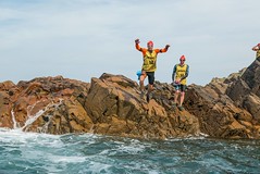
SwimRun Jersey (25-Sep-2016)
- 25 Sep 2016
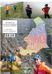
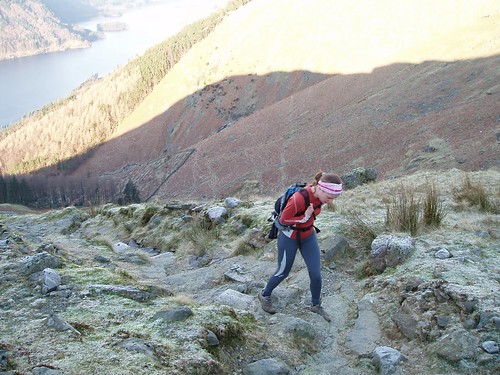
Bob Graham Round - Successful (04-Jul-2015)
- 04 Jul 2015
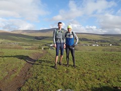
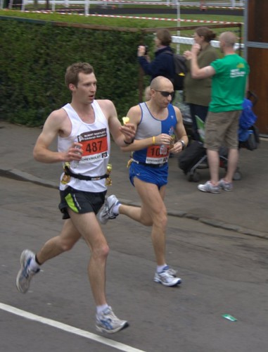
Running: Yorkshire Three Peaks (12-Feb-2011)
- 12 Feb 2011
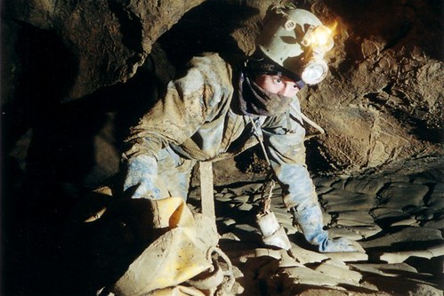
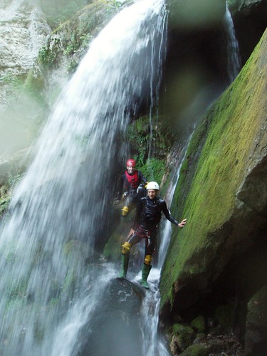
Vercors Caving Conference, August 2008
- 19 Aug 2008
-
-
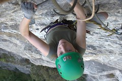
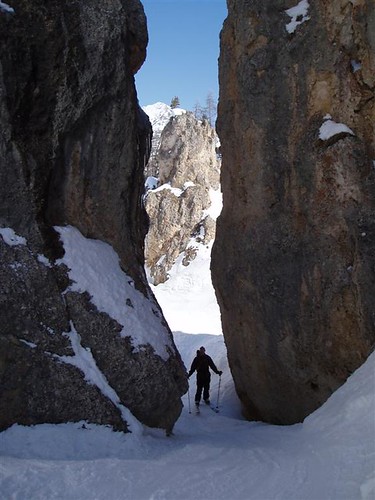
Mountain
-
Water
-
Swim | Bike | Run
-
Others


Blog
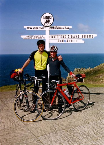
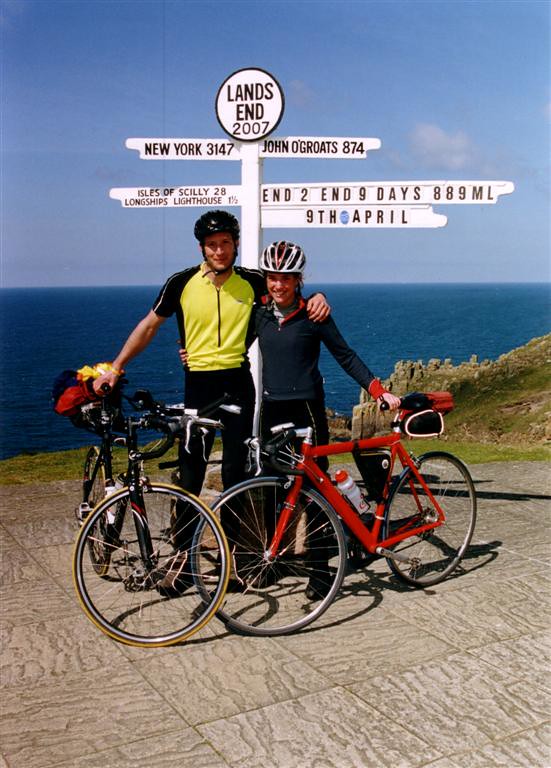
Yes we did it!! After 889 Miles and 9 days we finally arrived in Lands End. We had glorious weather for the whole journey without a drop of rain. We will write a full report and add some more photos as soon as possible.
John O'Groats to Lands End 2007 - Progress
Updated: April 9, 2007, 2:34 pm
Day 9: Wadebridge to Lands End
We have finally made it. After 889 miles in 9 days we are relieved and slightly amazed to have arrived. The weather is perfect and there are lots of tourists around. We have just had our picture taken by the Lands End photographer.
Thanks for supporting us on our journey. Our photos will appear here shortly.
Leaving the message short and sweet today in order to find food and ice cream.
Day 9 Statistics
Distance: 58.59 Miles (Total: 888.38 Miles)
Cycling Time: 04:21 (Total: 65:38)
Avg. Speed: 13.4 mph
Max. Speed: 36.1 mph
Height Gain: 1,035m (Total: 11,640m)
Height Loss: 1,005m (Total: 11,615m)
Updated: April 8, 2007, 7:11 pm
Day 8: Taunton to Wadebridge
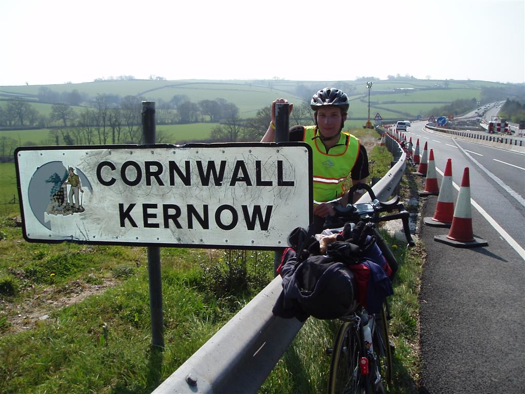
We're in Cornwall - Yeah! and yes the Cornish hills are steep, tiring and plentiful. We are very tired and legs are burning but we are glad to be nearing Lands End. Only about 60 miles to go now so all being well we should finish about lunchtime tomorrow.
We will update you further tomorrow when we are eating Cream Teas at the Lands End hotel.
Day 8 Statistics
Distance: 96.75 Miles (Total: 829.79 Miles)
Cycling Time: 07:39 (Total: 61:17)
Avg. Speed: 12.6 mph
Max. Speed: 35.6 mph
Height Gain: 1,685m (Total: 10,605m)
Height Loss: 1,660m (Total: 10,610m)
Updated: April 7, 2007, 9:00 pm
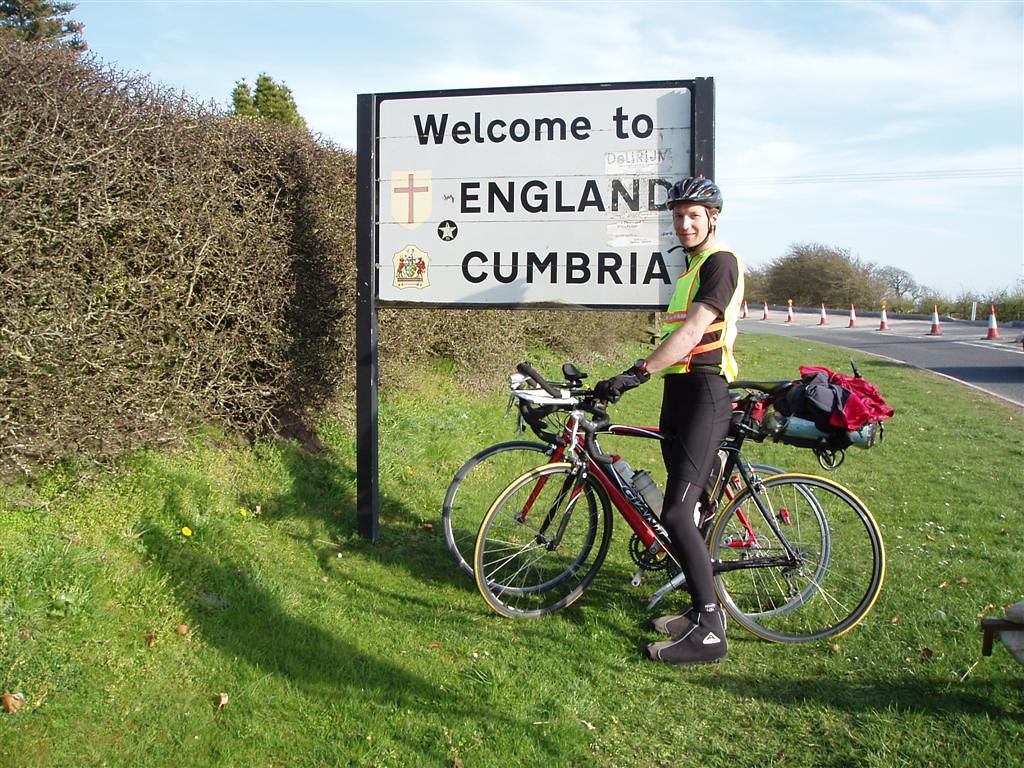
Day 7: Leominster to Taunton
We are both really tired, legs are hurting and we are glad to have arrived.
Today, started off with lots of hill climbing as we travelled into Wales and along the Wye Valley. It was exciting when we reached the M48 Bridge as it was a familiar place to be. We have both ridden it plenty of times before. It was then through Bristol and out onto the Mendips. It was great to reach the Somerset Levels where it flattened off for the final section to Taunton.
Yet again we are staying on the 3rd floor - are they punishing us or something.
Cornish hills tomorrow and last full day. Any happy thoughts gratefully received!
Day 7 Statistics
Distance: 111.19 Miles (Total: 733.04 Miles)
Cycling Time: 07:56 (Total: 53:38)
Avg. Speed: 14.0 mph
Max. Speed: 37.1 mph
Height Gain: 1,310m (Total: 8,920m)
Height Loss: 1,360m (Total: 8,950m)
Updated: April 6, 2007, 8:25 pm
Day 6: Charnock Richard (Chorley) to Leominster
Wow, what a fantastic day. We had a really good ride in beautiful weather and covered lots of miles (more than we were expecting) in a really good time!
The day started off misty and the cycling through the towns of Wigan and Warrington were very quiet as it's a Bank Holiday. The hills started as we headed towards Wales but were never too bad.
With only 3 days to go we are looking forward to finishing and it will be nice to cycle through an area we know tomorrow as we head to Bristol and then down through Somerset. So if any of you happen to be on the A38, in Bridgwater or Taunton tomorrow then give us a wave!
We're staying on the 3rd floor of a gorgeous old house and walking to the top is a bit of a chore. The poor legs are rather achy.
Blimey, I cant quite believe that we actually might make it. At first the distance was difficult to comprehend but now, as long as all goes well, we could really do it! Marvellous!
Greg and Helen
p.s. We keep getting sponsored by random people in pubs. Might make the £500 mark which would be great.
Day 6 Statistics
Distance: 114.53 Miles (Total: 621.85 Miles)
Cycling Time: 07:40 (Total: 45:42)
Avg. Speed: 14.9 mph
Max. Speed: 34.4 mph
Height Gain: 955m (Total: 7,610m)
Height Loss: 970m (Total: 7,590m)
Updated: April 5, 2007, 7:45 pm
Day 5: Carlisle to Charnock Richard (Chorley)
Oh hooray!! Always happy after a good curry and an entertaining ride!
We are now over halfway both in time and distance and getting into the routine of lots of cycling, lots of food and lots of sleep. Today, started off hilly as we climbed up Shap Fell and across the Lake District. Unfortunately cloud cover was very low in the mountains which obscured our views and made it really rather unpleasant. We had imagined a beautiful sunny and warm descent, but no! Waterproofs were put on swiftly and we were miserable and cold all the way to the bottom! Oh well, can't win them all I suppose.
Once out the mountains we had a nice, fairly flat ride along the A6 into Lancaster. However it then all slowed down as we hit the busy traffic and all the congestion of the towns near Preston.
Helen's knee amazed us by not causing any problems today despite the pain yesterday. Let's hope it holds out for the next 4 days! Send us happy thoughts everyone!
Only 4 days left! Bring it on...
Day 5 Statistics
Distance: 100.77 Miles (Total: 507.32 Miles)
Cycling Time: 07:56 (Total: 38:02)
Avg. Speed: 12.7 mph
Max. Speed: 32.5 mph
Height Gain: 1,380m (Total: 6,655m)
Height Loss: 1,380m (Total: 6,620m)
Updated: April 4, 2007, 8:39 pm
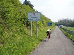
Day 4: Glasgow to Carlisle
Yeah - after over 400 miles we have finally arrived in England. Don't think I have ever been so pleased to arrive at a destination before. The first 50 miles was a real struggle as we fought against a headwind and up the hills. By lunchtime we had an average speed of just 12.2 mph. Helen's knee has also been causing her problems, but we are hoping that a hot bath and plenty of deep heat has done the trick.
Fortunately our speed picked up a bit after lunch and the wind and the hills died down.
The weather has again been fantastic again today - lets hope it continues.
Day 4 Statistics
Distance: 115.16 Miles (Total: 406.55 Miles)
Cycling Time: 08:36 (Total: 30:06)
Avg. Speed: 13.3 mph
Max. Speed: 37.6 mph
Height Gain: 1,080m (Total: 5,275m)
Height Loss: 1,075m (Total: 5,240m)
Updated: April 3, 2007, 6:51 pm
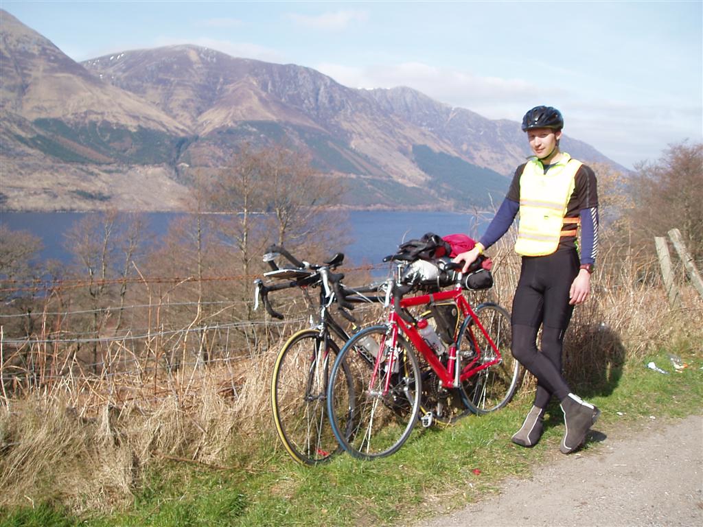
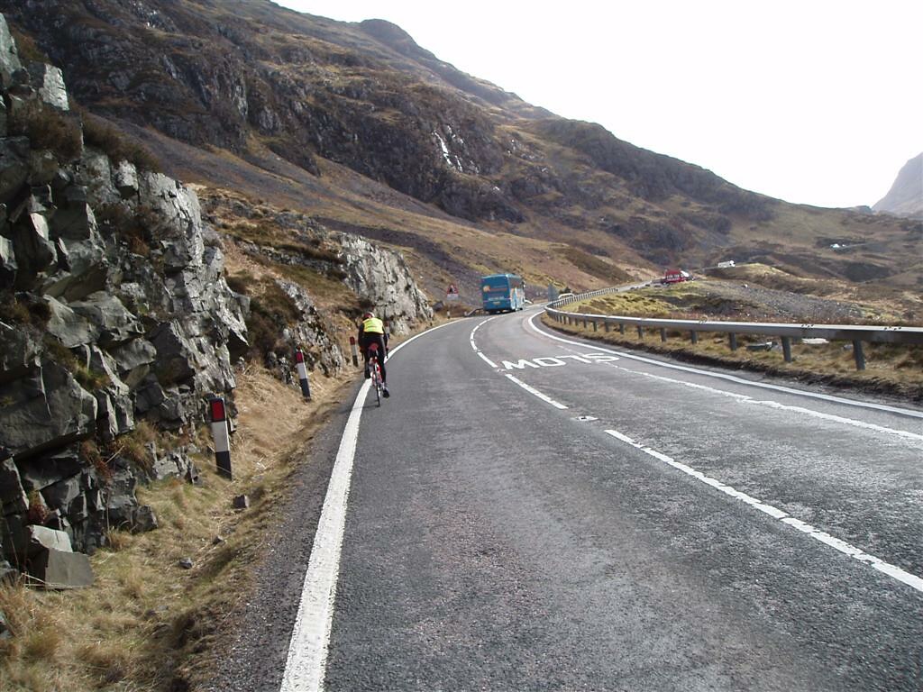
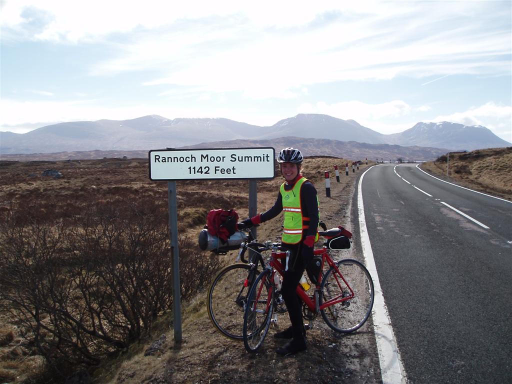
Day 3: Fort William to Glasgow
What a beasting! The first 10 miles out of Fort William were nice and gentle as we skirted around the loch. Then we headed into the hills and the long climb up Glencoe to the very bleak and windy Ranoch Mor. Things started to get better as we reached Loch Lomond and headed towards Glasgow, unfortunately the same couldn't be said for the state of the road. Cycling through the suburbs on the outskirts of Glasgow was an experience that hopefully won't be repeated.
We are now recovering in the pub. The waitress brought out four sets of cutlery because we ordered so much food - I've never seen Helen eat so much.
Aching and tired as usual - knees are particularly sore and we are finding it difficult to walk. Looking forward to our longest day tomorrow.
Day 3 Statistics
Distance: 106.27 Miles (Total: 291.39 Miles)
Cycling Time: 08:03 (Total: 21:30)
Avg. Speed: 13.1 mph
Max. Speed: 31.0 mph
Height Gain: 1,010m (Total: 4,195m)
Height Loss: 1,000m (Total: 4,165m)
Updated: April 2, 2007, 6:52 pm
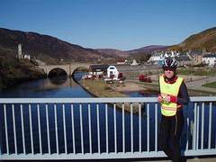
Day 2: Invergordon to Fort William
Glorious weather again today and magnificent views as we travelled from the East coast across the highlands to Fort William on the West coast. Unfortunately we didn't see the Loch Ness Monster but it was a really nice ride despite the terrible road conditions on the A82 along the Caledonian Canal.
Legs are quite sore now. Knees are feeling the strain and bottoms are a little unhappy. All good though, Helen has bought a knee support and now looking forward to hilly day 3... Oh joy!
The weather is forecast good again tomorrow with hopefully northerly winds as we head down to Glasgow.
Day 2 Statistics
Distance: 88.15 Miles (Total: 185.12 Miles)
Cycling Time: 06:22 (Total: 13:27)
Avg. Speed: 13.8 mph
Max. Speed: 34.7 mph
Height Gain: 980m (Total: 3,185m)
Height Loss: 960m (Total: 3,165m)
Updated: April 1, 2007, 7:36 pm
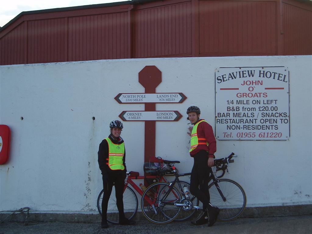
Day 1: John O'Groats to Invergordon
We have arrived at last after a hefty 97 miles. I am extremely relieved because I started the day feeling apprehensive about such a long ride in the scottish hills and potentially bad weather. However it is gloriously sunny and I even got up the first 13% hill of the trip without any problems!
So far my bum is rather contented because of the extra heavy duty padded cycling shorts I am wearing-Hoorah! Only 8 days to go...
Helen x
Day 1 Statistics
Distance: 96.97 Miles
Cycling Time: 07:05
Avg. Speed: 13.6 mph
Max. Speed: 33.5 mph
Height Gain: 2,205m
Height Loss: 2,205m
Updated: April 1, 2007, 10:09 am
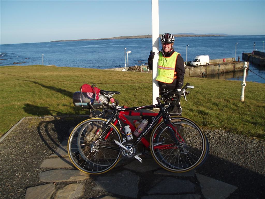
Travelling: Arrived in John O'Groats (31-Mar-07)
Last night we finally made it to John O'Groats after a day of travelling. The weather was excellent and we had a really nice moonlit bike ride in the evening from Wick to John O'Groats along the east coast of Scotland.
Luckily our bikes made it in one piece and are working very well at the moment.
We stayed at an excellent B&B and had a huge cooked breakfast this morning.
John O'Groats to Lands End 2007 - Charity
Our Chosen Charity was the Dorset and Somerset Air Ambulance Service.
John O'Groats to Lands End 2007 - Route Planning
The route:
John O'Groats
Wick
Inverness
Fort William
Bridge of Orchy
Glasgow
Carlisle
Kendal
Lancaster
Preston
Leominster
Monmouth
Chepstow
Bristol
Bridgwater
Taunton
Wadebridge
Lands End
John O'Groats to Lands End 2007 - Accomodation
| Day | Accommodation |
| Travelling 31st March 07 |
Mill House B&B |
| Day 1 1st April 07 |
Craigaron B&B Invergordon |
| Day 2 2nd April 07 |
Fort William YHA |
| Day 3 3rd April 07 |
Euro Hostel Glasgow |
| Day 4 4th April 07 |
Carlisle |
| Day 5 5th April 07 |
The Lodge |
| Day 6 6th April 07 |
Pinsley Guest House Leominster |
| Day 7 7th April 07 |
Acorn Lodge Taunton |
| Day 8 8th April 07 |
Little Pound B&B Wadebridge |
|
Day 9 |
Home!! |
John O'Groats to Lands End 2007 - Transportation Logistics
Public Transport in this country doesn't have the best of reputations so getting from one end of the country to other, with our bikes, isn't going to be easy. Searching the Internet there are loads of different options. We have settled on a route that suited our dates, and was as quick and as economical as possible. Here is the transport plan that we are going with:
Step 1: Drive to Newquay
On the Friday night we will drive to Newquay and pick up a pre-booked hire car from Europcar. The reason we chose Europcar is that they were the only self-drive company we could find that were situated in both Cornwall and Bristol Airport. Once we have the hire car we will drop our car of at Lands End (ready for when we finish) and then drive the hire car back to our house in the Mendips for a good night sleep. It is also possible to get a Europcar from Penzance, which is closer to Lands End, but they have much shorter opening hours which didn't suit us.
Step 2: Home to Bristol Airport
On Saturday morning we will take the hire car to Bristol Airport and drop it off at the Europcar offices their.
Step 3: Bristol to Inverness
Easyjet flight departing from Bristol Airport at 13:35 and arriving at Inverness Airport at 15:10.
Step 4: Inverness to Wick
Using the City Link Bus Service we will depart Inverness at 16:45 and arrive at Wick at 19:38
Step 5: Wick to John O'Groats
The easiest option now is to cycle the 16 mile from Wick to John O'Groats
John O'Groats to Lands End 2007 - Which Way?
The Traditional way of doing an end to end (e2e) tour is from Lands End to John O' Groats (LEJOG). However, as we live in the Mendips, Somerset, it is much easier for us to get to Lands End than it is to get to the Northern most point of Scotland. So we decided to get all the travelling done first by doing the route in the opposite direction: John O'Groats to Lands End (JOGLE). Also, psychologically, it's all down hill as you look at it on the map. Another reason is that typically the weather in Scotland is worse than that in Cornwall and we would prefer to have any bad weather at the start of the trip than at the end when we are tired.
Gallery
Yes we did it!! After 889 Miles and 9 days we finally arrived in Lands End. We had glorious weather for the whole journey without a drop of rain. We will write a full report and add some more photos as soon as possible.
-
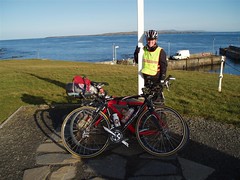
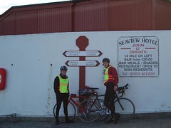 Greg & Helen at John O'Groats
-
 The Official Photograph
-
 Helen at John O'Groats signpost
-
 Helen eating yet more food
-
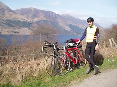 Greg overlooking Loch Ness
-
 Helen cycling up Glencoe
-
 Helen on Ranoch Mor
-
 Greg entering England
-
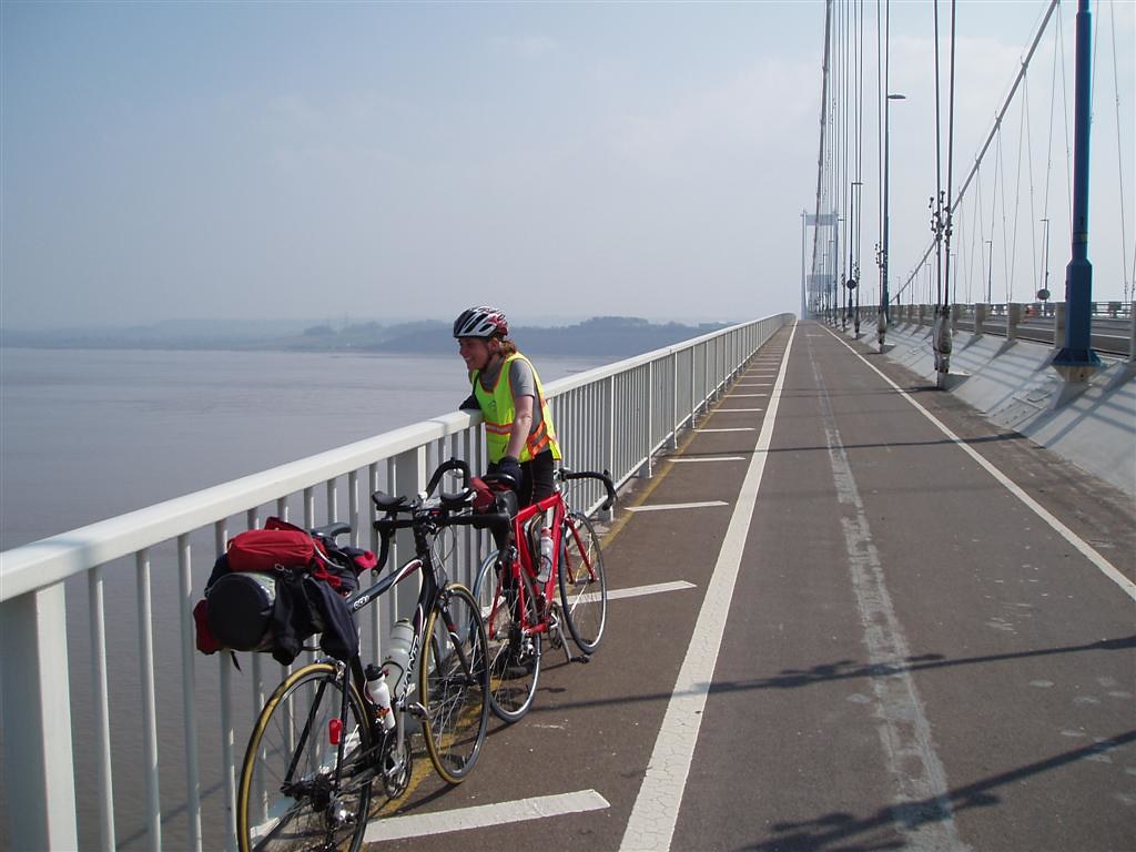
 Helen on the old Severn Bridge
-
 Helen going back into England from Wales
-
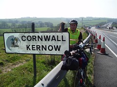 Greg on the Cornish Border
-
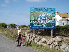 Helen at Lands End


Strava Stats
Recent Last 4 weeks
14 mi
02:04:14
826 ft
0 mi
00:00:00
0 ft
1 mi
00:44:39
Year-to-date
113 mi
16:22:42
9,011 ft
47 mi
03:29:01
2,184 ft
40 mi
25:24:57
All-Time Stats
10,346 mi
1432:03:58
809,530 ft
5,916 mi
505:55:16
441,165 ft
102 mi
69:44:12
Social
Recent Blogs
SwimRun Jersey (25-Sep-2016)
- 25 Sep 2016
Bob Graham Round - Successful (04-Jul-2015)
- 04 Jul 2015
Running: Yorkshire Three Peaks (12-Feb-2011)
- 12 Feb 2011
Vercors Caving Conference, August 2008
- 19 Aug 2008
Welsh 15 Peaks
- 29 Jul 2007
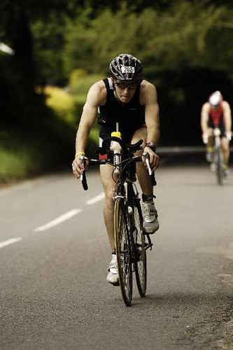
Half Ironman Triathlon (17-Jun-07)
- 17 Jun 2007